Digital Survey Documents Shipwrecks of Shackleton’s Quest and Scott’s Terra Nova
It takes more than routine underwater photogrammetry to impress Dwight Coleman. As director of ocean imaging at the Woods Hole Oceanographic Institution (WHOI), Coleman brings over 35 years of deep-sea experience, from countless research expeditions to archaeological studies of the RMS Titanic. His expertise spans deep-ocean exploration, robotics integration, and advanced imaging systems—so when he gets excited about a mission, there is usually a significant scientific reason.
Coleman was particularly enthusiastic about the recent Heroic Age Expedition, which produced the first comprehensive visual surveys and digital twins of the wrecks of Sir Ernest Shackleton’s Quest and Capt. Robert Falcon Scott’s Terra Nova. Conducted in partnership with the Royal Canadian Geographical Society, and supported by the U.S. National Science Foundation, the team used state-of-the-art tools to capture and document these historic wreck sites.
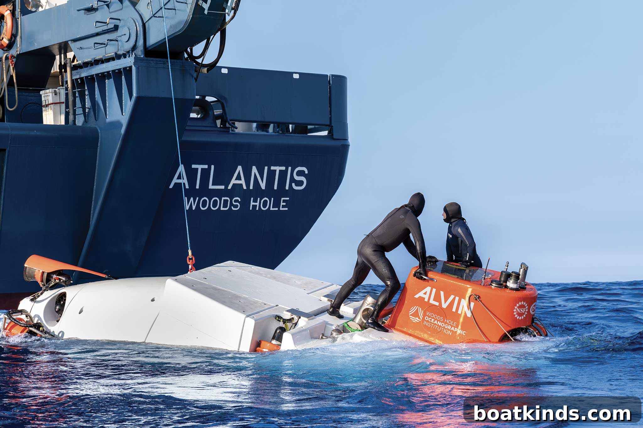
The survey combined high-definition 5.2K video cameras with Canadian VOYIS photogrammetric technology to create accurate, three-dimensional models. The NSF provided access to the research vessel Atlantis and the human-occupied vehicle Alvin. This mix of platforms and sensors allowed the team to collect high-quality imaging data much faster than in previous efforts—what once required a week was completed in just three days.
“Certainly the allure of Ernest Shackleton and Robert Falcon Scott—these are big names in exploration,” Coleman said. “These voyages happened more than a century ago, and we’re still dependent on ships to get to these remote sites. The technology has changed, but the challenges are similar: raising funds, assembling the right tools and teams, and executing in difficult conditions. Pulling this off in three days was remarkable.”
Coleman explained the imaging approach: one platform was the manned submersible Alvin, deployed for archaeological inspection, close-up photographs, and targeted imaging of artifacts. The other was a remote-operated vehicle (ROV) equipped with a VOYIS stereoscopic discovery imaging system—stereo cameras, LED lighting, and specialized mounting—which was operated from the surface vessel via tether. The ROV provided photogrammetric imagery that, when processed with dedicated software, produced precise 3D reconstructions or “digital twins.”
WHOI teams have been documenting deep-sea sites for years, Coleman said, but the integration of modern, high-resolution cameras and VOYIS photogrammetry enabled faster data collection and true three-dimensional outputs rather than traditional two-dimensional photomosaics. That improvement matters for conservation science and long-term monitoring.
One of the expedition’s primary objectives was to establish baseline documentation of each wreck’s condition. Age, depth, cold-water exposure and human activity all influence deterioration, and detailed 3D surveys allow researchers to track change over time. In this case, the condition of the wrecks offered both surprises and confirmations about how the ocean affects historic ships.
The Quest, lying nearly 1,300 feet under the Labrador Sea off Newfoundland, proved to be more degraded than Coleman expected for a wreck in deep, cold water. He noted extensive fishing gear entanglement and the presence of large numbers of fish—cod and redfish—congregating around the site. “I thought the Quest would be better preserved in that environment,” he said. “The amount of fishing gear and the sheer number of fish around the wreck surprised me.”
The Terra Nova, at over 900 feet off Greenland, showed different damage characteristics. While parts of the hull remain recognizable, the wreck appears to have struck the seabed forcefully and split open. Large sections are dispersed, the stern is partially buried in sediment, and much of the decking is deteriorated and collapsing.
The expedition’s imaging results and contextual findings will be shared publicly through multiple channels, including an upcoming documentary. Meta donated Ray-Ban Meta AI glasses to the team to provide a hands-free method for capturing and sharing the expedition in real time, enhancing public engagement with deep-ocean research and historical archaeology.
Looking ahead, Coleman and the Woods Hole team plan to continue similar surveys and expand partnerships with other research institutions, governments and industry. “Funding is challenging right now, so diversifying partnerships is part of our strategy,” he said. Collaborations with organizations that share a commitment to ocean science help enable ambitious projects and broaden outreach.
For WHOI, technological development remains central: improving deep-sea imaging systems, integrating robotics and refining photogrammetric workflows will enable better documentation of remote, fragile environments. Accurate, high-resolution digital records of historic wrecks support conservation, archaeological study and public education—and ensure that these underwater cultural resources are recorded for future generations.
This article was originally published in the October 2026 issue.